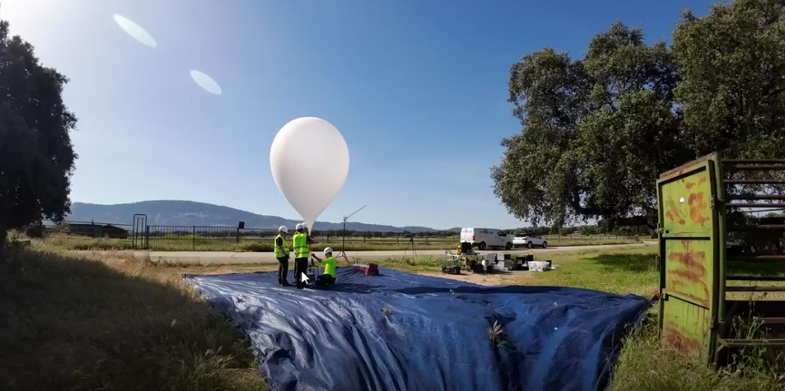
June 26, 2001 – The initiative, led by Cesefor, has been validated through a controlled burn in El Bierzo and is preparing for new flight campaigns in the province of Salamanca
As part of the RetechFOR project, a technology validation initiative has been carried out to test the use of unmanned stratospheric balloons (known as microhaps) for forest management applications. The initiative, part of the RetechFOR Continuous Forest Inventory subproject, was coordinated by Cesefor with the participation of two of its project partners, ITCL and Vexiza, and drew on the technology and flight expertise of the company B2Space.
Microhaps operate at an altitude of between 20 and 30 kilometers, in what is known as the lower stratosphere, which sets them apart from conventional drones and satellites and opens up possibilities for observation and coverage that are difficult to achieve with other technologies.
According to Ángela Blázquez, head of Cesefor’s Forestry and Climate Change Division, the initiative involves “two applications of a technology we wanted to test: stratospheric flights using unmanned balloons that reach altitudes of about 20–30 kilometers—one for fire detection and the other for pest detection.”
Detection of secondary fires in El Bierzo
On April 28, the first validation flight took place in the El Bierzo region (León), within the coverage area of the Cueto de Ponferrada base, for which a controlled burn was carried out under the coordination of the Regional Government of Castile and León. The objective was to verify whether the technology is capable of detecting secondary fires in forest fires using infrared video cameras aboard the balloon.
The balloon, equipped with an infrared camera and an optical camera, features a targeting system that allows it to focus directly on the point of interest. In addition, all captured data is transmitted in real time via satellite communication to control centers, enabling field teams to make immediate decisions.
Julio Verdasco, B2Space’s head of sales, notes that “we successfully covered the entire area we needed to fly over; validation was achieved, and it was a success. This has a direct application in fire management, because all the information is downloaded in real time via satellite communication so that field teams can make decisions.”
Early Pest Detection in Salamanca
The second application studied focuses on the early detection of infestation by the pine wood nematode (Bursaphelenchus xylophilus) in forest stands. In the coming days, microdrone flights will be conducted in the La Lagunilla area (Salamanca), with two operations planned (two flights per campaign) to cover defined areas of the territory. Between campaigns, fieldwork will be carried out to identify trees affected by the pest and to cross-check that information with the data obtained from the air.